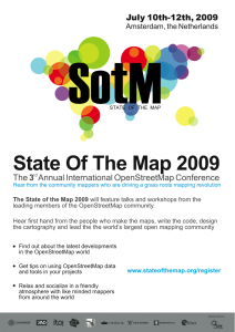
For this year’s edition of State of the Map we had a talk with Maarten Oldenhof, Chief Executive Officer of AND Automotive Navigation Data. AND is the only independent mapmaker, has contributed to OpenStreetMap since 2007 and is sponsor of the conference.
Why have you contributed to OpenStreetMap?
As a mapmaker we always want to be at the forefront of new developments. You can wait and see what is happening around you, but that is not what AND is about. We want to be involved with new trends in the world op maps and location and we regard OpenStreetMap as an interesting development that aligns with the views we have on the future, where location based services will be hot.
Can you explain more about your partnership with OpenStreetMap. How are you leveraging the relationship to support AND’s long-term objectives for revenue growth?
AND Automotive Navigation Data has donated digital maps of the Netherlands, India and China to OpenStreetMap in 2007. The Dutch OSM community has added a lot of detail to this map, such as pedestrian areas, cycle paths, POIs, etc. With the donation AND recognized the power of a community, User Generated Content and the Web 2.0 developments. We call this Map 2.0, another example of this is AND Map 2.0 (www.map20.org).
Don’t you see OpenStreetMap as a threat to you business model?
Not at all. We regard it as an important development that adds to our view that knowledge about your whereabouts and all the relevant things in your area is a key trend. That’s why we are enjoying the cooperation with OpenStreetMap and are looking forward to share views with the other participants.
A lot has been said about user generated maps and, a potential shake up of map provision and licenses. What’s your take on the situation, especially in light of OpenStreetMap coming to the fore?
AND Automotive Navigation Data is the only independent mapmaker left over in the market after the takeover of TeleAtlas by TomTom and Navteq by Nokia. AND has profited from these developments by signing a contract with a big US company. With this contract AND proves to be an alternative to the other players in the market for maps for Western Europe.
AND believes in the power of a community and the Web 2.0 developments. In the long run we believe there will be room for all, like Linux next to Windows and Microsoft Office next to Open Office.
How is AND doing this year, in the wake of the global recession?
We are experiencing a great year. In April we announced a large contract with a big American online company for the delivery of digital maps for Western Europe. As a result, AND expects sales to triple and profit to increase five-fold in 2009, compared to 2008. Apart from this contract there are more opportunities for further organic growth, not only by the continuing strong growth of Smartphones, but also by the efforts of other players in the online market who try to capture a position on the mobile internet through location-based services. In the future, almost every mobile electronic device will be fitted with GPS capability, giving huge growth in the use of maps.
How will AND compete with new “live maps” that can be created by companies offering user generated traffic reports such as Waze and Dash Navigation (now owned by RIM)?
For a navigation map you need many navigation attributes. The “live maps” cannot generate all these attributes. In the AND Labs we always look at how we can showcase and produce our maps. We are also looking at automated mapping generation based on GPS tracks, pictures, etc.


 O
O Oer
Oer About
About Over
Over Honi buruz
 About
About About
About About
About Über
Über Sobre
Sobre